Zion National Park

Utah's first (and busiest!) National Park.

Friday morning, we packed up the car around 5:30 am and were
out the door by 6 am. The plan was to
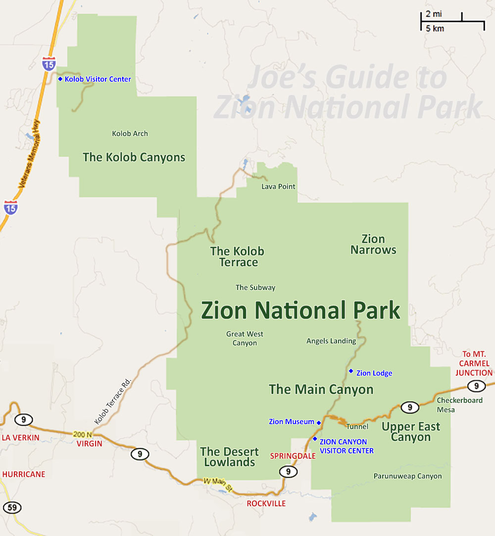
head South down I-15 and in Southern Utah cut East and come into the park from
the opposite end. This was a good way to
drive a “loop” around Zion instead of heading straight down 15,up the Canyon
road, and back the way we came.

(Take the route not highlighted- coming into Zion from the east and through the tunnel).
This
allowed us to come through the Zion/Mount Carmel Tunnel, drive up and down the
National Park Canyon Road, and then out a different way we came. I think the mileage is pretty similar for
both routes and may add a little extra time (worth it!). We got to Zion around 11:00 am after a stop or
two along the route. It was a gorgeous
sunny day in Southern Utah.

(All information taken from the National Park guides handed out at the park ranger station).
When you come in this "other way", you come through the Zion-Mt Carmel Tunnel that connects Zion
Canyon to the east side of the park.
There are a series of two tunnels, the larger/longer tunnel built in the 1920’s. If your vehicle is 11’4” high or higher, or 7’10”
wide or wider, you are going to require one lane traffic control through the
tunnel (nearly all RV’s, buses, trailers, fifth wheels, dual wheel trucks
campers and boats require this traffic control at cost of $15 per vehicle- good
for two trips through during a seven day period).
This service is only allowed November 2nd
to May 2nd. I recommend if you are in a large vehicle enter the park the other end (highlighted on the map) and avoid the tunnel altogether.

It is a very long, very dark tunnel, with a few cut outs in the tunnel that allow for natural light. Pedestrians and bicycles are NOT allowed in the tunnel because the lane is only wide enough for a car. If you are walking or biking the road, you will need to catch a ride through the tunnel.

From November 30th to March 14, the Zion Canyon
Scenic Drive (the main road through the park where you access all trail
heads) is open to private vehicles. Be warned, parking may be an issue on weekends
on the popular trails when the shuttle is not in service.
The rest of the
season, March 15th to November 29th, you can only access
the park through a shuttle system. You will not be able to drive your car into the park. The
shuttle stops at all trail heads, lodges, and centers, and eliminates all those
cars on the one Canyon Road and all parking issues.
Each full shuttle reduced traffic by 28 cars, reducing vehicle miles
traveled per day by over 50,000 and reduce CO2 emissions by over 12 tons a
day.

The fee to get into the park is: $25 per vehicle, or $12 per individual:
pedestrian, bicycle, motorcycle, or organized group. This gives you a seven day access for the
park. Other options include a Zion
Annual Pass for $50, an Annual Pass to all federal fee areas for one year (what
we did) for $80, a Senior pass admission
to all federal fee areas for LIFE (U.S. citizens 62 years or older) for $10, or
an Access Pass to all federal fee areas for permanently disabled U.S. Citizens
for free. Our $80 pass will get us into
all National Parks and National Fee areas for the year, which is a great deal
if you plan to see a few parks over the course of the year (this is our 3rd
National Park already!).

Need To Know: Even in
March, it was very hot hiking in the sun at Zion. Sunscreen, sunglasses, hat, and plenty of
water is a must. Experts recommend one
gallon of water per person per day.
Water is available via water pumps at the visitor center, campgrounds,
Zion lodge, and other locations around the park. According to the Zion newsletter, hypothermia
is the number one killer of outdoor recreationists. It gets quite cold at night in the desert and
hiking in the Virgin River in the Narrows can be cold (immersion in water is
the quickest way to lose body heat!).

The Narrows is the famous hike in Zion National Park where
you actually hike IN the Virgin River.
The gorge is 16 miles long and up to 2,000-feet deep, with some widths as
narrow as 20-30’. Atleast 60% of the
hike is spent wading in water and depths can reach waist to chest deep. Flash flooding in a major concern for this
area. A dry suit is needed in the winter
and a walking stick is recommended at all times for the slippery rocks in the
river bed. There are three ways to hike
which I will talk about in my trail post, but what you need to know is two of
the ways to hike the Narrows requires a private shuttle and a permit.

Wilderness Permits are required for overnight trips, through
two of the ways to hike the Narrows, and any technical climbing, back country,
or overnight trips. Wilderness permit
fees are based on the size of your group:
(10$ for 1-2 people, $15 for 3-7 people, $20 for 8-12 people). To hike the Subway, the famous section of the
Narrows, a permit is required. 40
permits are registered on a reservation basis and 40 are kept for first come
first served trips.
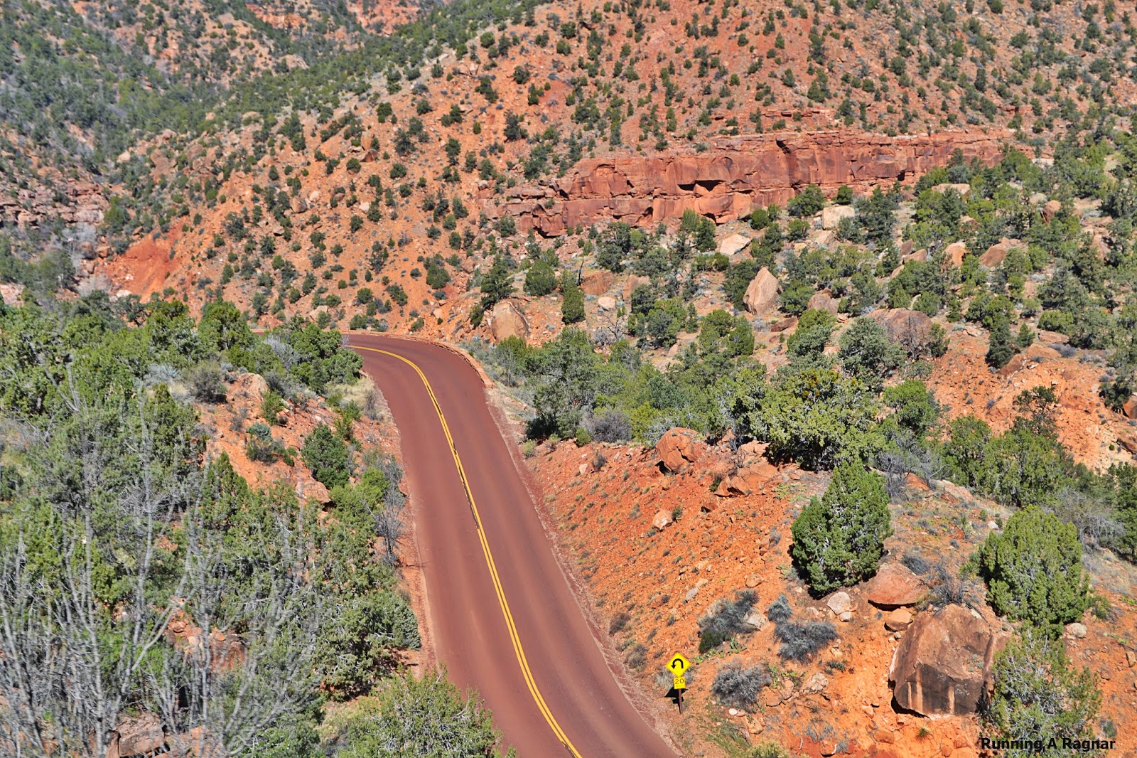
Alright, now you know the basics, and saw some beautiful pictures of the drive into the National Park. Let's start talking about those iconic hikes!

(http://www.citrusmilo.com/zionguide/gettingaroundzion.cfm)
Most popular Zion Hikes
Trail head: Weeping Rock Parking Lot
Distance: 8 miles
Trail head: The Grotto Picnic Area- Zion Canyon
Distance: 5 miles
Trail head: Zion Lodge
Distance: 3 miles

Trail head: Temple of Sinawava
Distance: 2 miles
Trail head: Immediately east of the Zion-Mt. Carmel Tunnel by the ranger booth.
Distance: 1 mile
Pa'rus Trail (biking and dogs allowed)
Trail head: Canyon Junction - The spur where the Zion-Mt. Carmel Highway and the Zion Canyon Road intersect.
Distance: 3.4 miles


No comments :
Post a Comment
Let's Chat!