Sometimes life can be stressful. Whether its work, relationships, family or friends, sometimes you just need to get away. I had been toying with the idea of a few different trips, Portland, Nevada, and Idaho, and last minute decided to do a day trip to the closest one, Idaho. Sometimes all the stress piles up and I get a feeling of crushing anxiety in this little apartment in the city. So when life (and a few days of bad weather) has you feeling down, a road trip to somewhere new is in order.

If you know me, you know I have a love for the water. And here in Utah, the second most arid state in the country whose landscape involves a lot of desert (and mountains of course), water is hard to come by. I spend a lot of time googling Utah's lakes and rivers. I have to admit I have seen many of them and they leave a lot to be desired (This New England native loves a good coastline and sandy beach). Let's just say I set my expectations high.
So we headed north to Idaho to see this lake. All in all it was a great adventure of two states, a turquoise lake, some awesome Mexican food, two scenic by ways, beautiful landscapes and a trunk full of cheap cold beer.
It was a good trip.

Bear Lake is half in Utah and half in Idaho. and Idaho has been high on my "Need to see more of" list. Driving through Idaho to reach Jackson Hole last winter I was stunned at how beautiful Idaho was. The state is known for potatoes, but picture beautiful lakes, waterfalls, and mountains. Who knew? To get to Blue Lake, we got in the car and headed north up I-15. We then drove through Logan and Logan Canyon, up the Oregon Trail Scenic Byway past the lake and then down the Pioneer Scenic Byway, to form a loop before heading back home once we hit Logan and I-15. Just over 2 hours to get to the Bear Lake State Park on the Utah side, with a total loop of 5 hours and 20 minutes, and roughly 300 miles. My kind of day trip.
 |
| Entrance to Logan Canyon Cache National Forest |
Once we reached Logan Canyon, we entered the Cache National Forest. This is a part of the state I haven't seen or heard much about. Logan Canyon was beautiful and its always great to see another section of this crazy state. This scenic drive through Logan Canyon extends from US-89 to Logan, out of the canyon to Garden City and eventually Bear Lake. A river runs through the canyon, and you pass various camp sites, day areas, and groups of snowmobilers on snowy open areas.
 |
| Driving through Logan Canyon |
 |
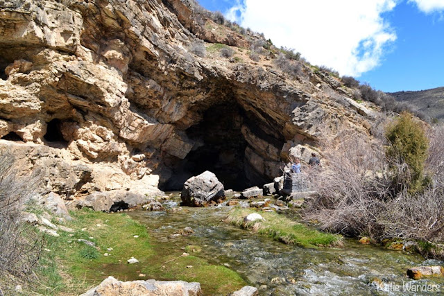
| Rick's Spring, Logan Canyon |
Also off the route through Logan Canyon you can find the natural spring Rick's Spring. Thomas E. Ricks settled in the nearby Cache Valley in 1859. Logan Canyon was an area rich with timber and other resources for nearby settlements. Ricks Spring is a karst spring, a natural water outflow from a cave in Logan Canyon within the Wasatch-Cache National Forest in northeast Utah. It is quite cool to see the bubbling water coming from the ground of the cave, feeding the river extending out of the cave.
 |
| Bear Lake visitors center |
At the end of the canyon, you will come across the Bear Lake visitor's center, and your first view of the beautiful Blue Lake. The visitor's center is right off 89, and has brochures, bathrooms. grills, picnic tables, and a viewing area with signage.
 |
| Bear Lake visitors center |
 |
| View of Bear Lake from the Visitor's Center |
 |
| Sailboat leaving the marina at Bear Lake |
The third largest lake in Utah (Great Salt Lake the largest, and and Utah Lake the second) is found in the far northeast corner of the state . Bear Lake covers 110 square miles, stretching for 19 miles at the foot of the northern Wasatch Range. The lake drains northwards via a tributary of the Bear River , half of the lake in Utah and the other half in Idaho. There are paved roads that give easy access to much of the shoreline.
How did it get that beautiful color? The turquoise-blue color of the water is caused by suspended limestone particles eroded from the surrounding mountains, earning the name the "Caribbean of the Rockies".
There are two state parks, one on the Utah side and one on the Idaho sign. We stopped into the park on the Utah side to see a large marina and a sailboat heading out into the lake.
 |
| Turquoise Waters of Bear Lake |
 |
| Marina at Blue Lake |
 |
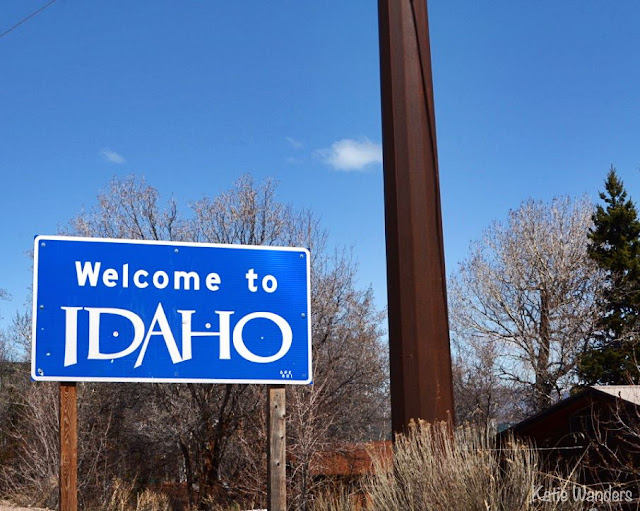
| Idaho sign at the border |
We continued on to Idaho to complete a loop before heading back to Utah. Our plan was to find something to eat in Idaho and most importantly, find a store where we could find some local beer and high point beer on draft. I have to say we looked like kids in a candy store as we entered the beer cave in the grocery store, to be delighted by some of our favorite cases of (cold!) beer, local Idaho beers, all for much cheaper than Utah prices.
 |
| Oregon Trail Sign |
We were surprised to find that once we crossed the border, we were on another scenic (and video game made famous) drive. The Oregon Trail - Bear Lake Scenic Byway begins at the state border, where it runs 111 miles north then west for 100 miles. Back in early mountain man days, the Bear Lake area was the scene of several rendezvous (gatherings of mountain men, fur trappers, Indians and peddlers and traders out of St. Louis). You can read all about the real Oregon Trail here. We stopped to read the sign, while we continued on the trail without losing any of the oxen on the river crossing or any bouts of dysentery (we all remember the game).
Back on the main road (US Highway 89), you'll pass through Paris and Ovid before coming to Montpelier. Montpelier was settled by Mormon pioneers who originated from the area of Montpelier, Vermont (hence the name). Montpelier is the "big city" in this part of Idaho and near the main road junction in the middle of town is where you'll find the National Oregon/California Trail Interpretive Center. And some really good Mexican food.
 |
| Bear Lake State Park North Beach, Idaho |
This part of Idaho doesn't have a whole lot in the name of towns and restaurants. I did a little research and we headed to the town of Montpelier to a Restaurant called "El Jaliciense". We pulled into the restaurant, a small log shack in the same lot as the gas station, where the windows were covered with one way screens of horses, and the bathrooms were located outside. By the name and the first sight, it was the kind of place that was the best dive in town or where you got food poisoning. Judging by the 4.5/5 star Yelp review, we were hoping for the first option.
The menu was huge, the prices were cheap, and there was an abundance of Pacificos in the cooler. Our waitress brought over delicious chips and salsa with refried beans, before bringing out our amazing entres. Let me tell you, the carne asada in Idaho is rockin.
 |
| Carne Asada, El Jaliciense |
 |
| Pioneer Historic Byway, Idaho |
The last part of our drive followed another famous scenic byway, the Pioneer Historic Byway. On our way, we passed this 107-year-old barn. What really caught my eye is the words on the barn, although it's a landmark for drivers heading to and from Logan on U.S. 89-91 who pull over daily to point and shoot the barn. On the front it reads "The Woman's Tonic -- Dr. Pierce's Favorite Prescription." The tonic was a late 19th and early 20th century cure-all for any and all ailments of women. The barns were a way to advertise, and there are Dr. Pierce barns in Oregon, California, Washington and New York.
This barn caught my attention because of an old bottle I have sitting on my shelf. I found it while scuba diving in Stonington, sitting in the sand with the words "Dr. Pierces Favorite Prescription, Buffalo NY" on the bottle. A little reminder of friends and home via peeling paint on an old Utah barn.
 |
| Dr. Pierces Advertisement old barn |

We finished driving through beautiful Utah, and were back in Salt Lake City for a late dinner. Idaho is a gorgeous state, so much more than my preconceived notions of a state known for potatoes. Browsing through my Idaho magazine I grabbed at the visitors center, I was amazed at the beauty of this state (google Shoshone falls).
I am already planning a trip back.
 |
| Source |
OTHER ATTRACTIONS IN THE AREA
Minnetonka Cave
Minnetonka is the largest limestone cave in the state. Located near the town of St. Charles, the cave is a geologic wonder dating back nearly 320 million years. Breathtaking passageways extending more than 2000 feet into the hill side contain nine rooms of fascinating stalactites, stalagmites and banded travertine. Located outside St. Charles on paved St. Charles Canyon Road, which leads 10 miles west up St. Charles Creek to the cave. 42° 5'17.12"N, 111°31'9.79"W
National Oregon-California Trail Center
The National Oregon-California Trail Center is located in Montpelier. The center has on display the "Living History," a dramatic recreation of the pioneers' journey from Missouri to Clover Creek. Located on the actual Clover Creek Encampment site, the center offers visitors a unique opportunity to experience pioneer life as it was more than a hundred years ago. 322 N. 4th Street, Montpelier. 42°19'19.69"N, 111°17'51.37"W
Bear Lake National Wildlife Refuge
Established in 1968, the wildlife refuge is a major nesting area for Great Basin Canada geese, sandhill cranes, and mallards, pintails, canvasback, and redhead ducks. Other waterfowl include herons, egrets, terns, rails, ibis, bitterns, grebes, avocets, and white pelicans. The refuge’s Mud Lake Unit is a favorite resting area for several thousand ducks and geese each spring and fall. Photo by Jim Parker. 42°14'12.67"N, 111°21'12.63"W
Turn East from U.S. 89 in Paris onto Second North and travel 2-1/2 miles.
Pyramid Springs and Soda Springs Geyser
Soda Springs boasts having the world's only captive geyser. On November 30, 1937 in an attempt to find a hot water source for a local swimming pool, a well driller set free the natural geyser at a depth of 317 feet. It is located on Pyramid Spring, a travertine mound described by Fremont in his 1840s expeditions, along with other area springs. The history of Soda Springs and Caribou County is portrayed on picture boards in the Geyser Park Visitor Center. Historical artifacts and antiques are on display next door at the Enders Hotel Museum. Enter on Main Street & 1st Street South and drive 150 feet west to Geyser Park.
42°39'26.13"N, 111°36'17.32"W

Logan Canyon is one of my favorites! You should do the wind caves hike sometime before you move! Maybe we should go camping up there? Brighton and I have been wanting to for a while!
ReplyDeleteLogan Canyon was so beautiful! And I have heard great things about Wind Caves!
Delete