Our first official stop of the trip was to hike and stop along Waterfall Drive. Now waterfall drive isn't a real thing, but it's the pseudo name we made for the beautiful drive along Historic Columbia River Highway (a scenic byway - Route 30 in Oregon). You could easily spend a few days driving down this 70 mile scenic drive, hiking and exploring all of these trails, parks, and viewpoints along the way (and I would have lovvved to). However, we were on a tight schedule so we had to improvise. A hike, a few stops, and lot of fun exploring this area (I had never even heard of until this trip!).
 |
| Historic Columbia River Highway Map |
Our "Waterfall Drive Waypoints" were:
--a Hike at Horsetail Falls, Ponytail Falls and Oneonta Falls,
--stopping to view Multnomah Falls,
--a stop at Guy W. Talbot State Park to see Latourell Falls,

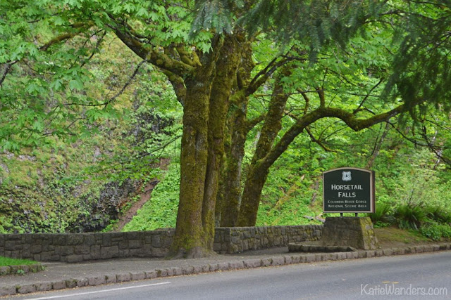 |
| Horsetail Falls Trailhead |
This spectacular hike brings you through the dense green forest of Oregon and past several waterfalls (three, in one hike!). There is a parking area and a trailhead where you can access the loop trail, and a few trails springing off the main loop.
The loop takes you to from the beautiful Horsetail Falls, in this amazing cavern under Ponytail falls, and over a bridge to Oneonta Falls before ending back at the Columbia River Highway. Once on the road, you can follow the trail along the road (and under a very cool tunnel) back to the parking area at Horsetail Falls. There is also a trailhead at the Oneonta Falls end of the trail, and the loop can be done in either direction. The entire loop is about 2.6 miles and climbs 610' in elevation.
Bridges, lush green forest, 3 waterfalls, tunnels, and a scenic drive.
This is an amazing hike that should be on every Oregonian and Road Trippers list. 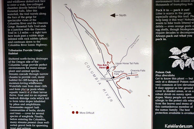 |
| Horsetail Falls Trail Map |
Horsetail Falls is the first waterfall on the trail. It is a beautiful 176' waterfall visible right from the road. There is a nice little area to stop and take a picture, before continuing onto the trail to see the other falls. Just the right amount of beautiful to jazz you up for a nice hike to see a few other falls.
 |
| Horsetail Falls |
 |
| Horsetail Falls |
We hiked along the trail for a little while, climbing higher into a dense green misty forest. In true Oregon/Pacific Northwest fashion, it went from warm and sunny to misty and rainy on and off along the hike (but lets me honest, mostly rainy). We felt like we were in a remote section of a rainforest, where everything was so wet and so green. Use caution as some of the rocks along the trail stay almost permanent wet, and very slippery. Also beware (and know how to spot) poison oak along the trail. I had my Poison Everything radar on and did not spot any during our hike.
The trail has a few different turn offs to other trails, just keep following the well marked signs to Oneonta Falls.
 |
| Ponytail Falls |
 |
| Ponytail Falls |
The trail crosses under Ponytail Falls (upper horsetail falls on the map), giving you a different perspective of this booming waterfall. The waterfall drops into a pool, before continuing its way down to the lower park of the fall. This is also a great spot to stop and dry off, waiting for the rain to pass. Luckily, we packed our raincoats and were ready to continue on the trail. Its an awesome perspective to be on the "inside" of a waterfall.
 |
| Trail under the rock of Ponytail Falls |
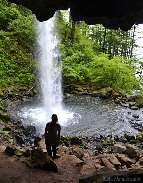 |
| View behind Ponytail Falls |
After a short while, you pass a beautiful little steel bridge (which warns of some wear and tear and one passenger at a time...) and get a view of another waterfall, Oneonta Falls a smaller but scenic waterfall at 100'. You will also get a great view of the Oneonta River flowing down the gorgeous Oneonta Canyon (man is the water clear!). This fall will be much less busy as there is no road access to the waterfall, only hiking. This is a great spot to enjoy a snack, solitude and the views.
 |
| Oneonta Falls |
Eventually, you descend back down the trail and wind up back on the road. You will follow the road East, through this beautiful tunnel, before arriving back at your car at the trailhead by Horsetail Falls. If you want to do this hike the other way around the loop, there is also a parking area at this end of the loop trail.
Summary: Beautiful 2.6 mile loop at 610' elevation gain. Dogs allowed on leash, no fees and no restrooms. Loop can be hiked either from the Horsetail Falls TH or Oneonta Falls TH. Either way you will have to walk on the road for about a half mile, use caution as the shoulder is narrow. Keep your eyes peeled for poison oak along the trail. Pack a rain coat as it is often raining and misty in this area. The fall is located about 2.75 miles east of popular Multnomah Falls on the Historic Columbia River Highway. It can be accessed off I-84 East exit #28 (turn left and follow the road for six miles) or I-84 West (exit 35 travel west for 1 mile).
 |
| Tunnel following the Historic Columbia River Highway |
We were so happy to get out of the car and stretch our legs after a long ride from Boise, Idaho. While I would have loved to hike every trail along this beautiful road, we were on a tight schedule. Instead of hiking, we stopped to take in the view at a few other waterfalls.

 |
| Multnomah Falls |
 |
| Bridge at the underpass from the highway access to Multnomah Falls |
Multnomah Falls is the big daddy of waterfalls in this area. This 611 foot fall is a beautiful scenic stop along this historic highway. It is the tallest waterfall in the state of Oregon, and one of the tallest year round waterfall in the United States. There is even a walking path up to the 45' Benson Bridge at the break between the lower and upper falls. You will have an up close view of the 542' upper fall, and a nice view down the 69' lower fall. If you don't like heights, you may want to stay on the walking path. If you continue hiking another mile past the bridge, you can access the top of the falls.
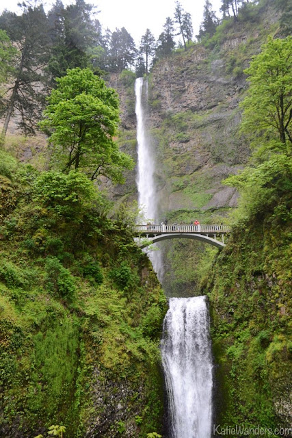 |
| Multnomah Falls and Benson Bridge |
You can even see the falls from the roadway, and a five minute walk brings you to the base of the falls. Because of its location right next to the road, this is a very popular tourist stop, with a gift shop, restaurant, and US Forest Office in the beautiful building built in the 1920s for tourists visiting the area. You will see the exit directly off I-84, and also off the historic route we were driving down (which I of course deemed Waterfall Drive). Beware, there were a lot of signage warning against items being stolen from cars. Make sure anything valuable is out of sight as you go to visit the falls.
 |
| Multnomah Falls and Benson Bridge |
 |
| Restaurant, gift shop and ranger station |
Summary: Dog friendly on leash, no fees, very crowded (be patient as there are a lot of kids and older tourists on the trail). To access the falls, take I-84 East to exit 31 where a path will take you to the falls. Or like we did, you can access the waterfall off the Columbia River Scenic Highway. Trail maps available and hiking options to the top and around the falls.

 |
| Latourell Falls |
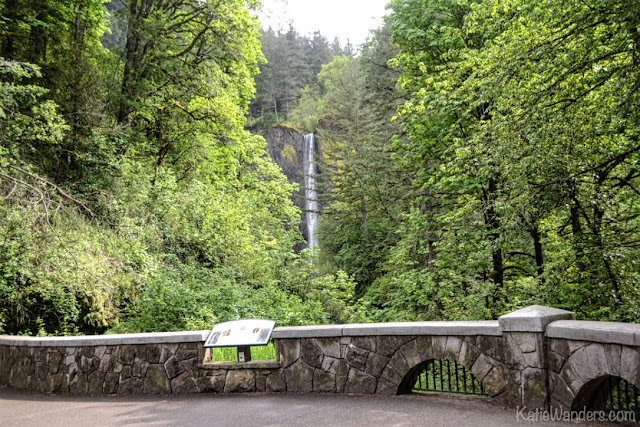
This is when you start to get spoiled in waterfall acceptance. You had just hiked three gorgeous falls on the Horsetail Falls loop, followed a trail to an amazing bridge at the split in Multnomah Falls, and continued on down the Historic Columbia River Highway. For us, Latourell Falls was a quick (but worthy stop). You can access the falls through the Guy Talbot State Park, and complete a 2.5 mile loop hike around the falls. You can only see the lower falls from the road, and need to complete the loop hike to see the upper falls. The waterfall was beautiful and we opted for a quick photo stop before continuing our way to the Vista House.
 |
| Latourell Falls |
Summary: What makes this waterfall worth the stop and so unique is the way it falls dramatically straight down off the cliff side (no tumbling or diversions, just a straight drop down 224 feet. The trail is about 2.5 miles, 390' and dogs are allowed on leash (no fees, restrooms are available). The falls were named for Joseph Latourell, a well known settler of the area. Guy Talbot originally owned the falls before donating the land to and falls to the state park system. The falls are located 5 miles east of Crown Point/Vista House.
 |
| Latourell Falls viewpoint and infographic |

No comments :
Post a Comment
Let's Chat!